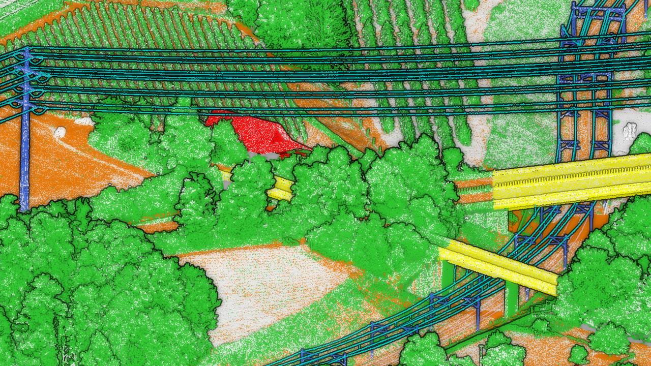
Classified point clouds from photogrammetry and LiDAR
Point clouds provide high-resolution 3D geometry for reliable planning and analysis processes. We capture sites, corridors and topography with modern laser scanners and camera systems. Through automated and manually verified point classification, we cleanly separate ground, structures, vegetation and infrastructure for direct further processing in CAD, building information modelling (BIM) and GIS.
Key facts
What you use point clouds for
Point clouds are the most accurate way to capture a place in three dimensions. Plans, models and analyses are derived from them.
Railway sites and track planning
We capture data in the required reference frame (for example LV95 SBB) for exact determination of track geometry, clearance gauge checks and switch planning, without interrupting ongoing railway operations.
A good fit for Construction & InfrastructureAs-built surveys for BIM and building construction
Centimetre-accurate 3D as-built models serve as a planning basis for refurbishments, conversions and heritage conservation. Structured point clouds can be imported directly into Revit, Civil 3D or ArchiCAD.
A good fit for Construction & InfrastructurePower line and route corridors
The point cloud precisely separates overhead line routes, pylons and vegetation. It serves as a basis for automated clearance checks, sag calculations and vegetation management.
A good fit for Construction & InfrastructureDigital terrain model under forest
Thanks to multiple echoes (multi-target capability), LiDAR pulses penetrate a dense canopy and capture the actual ground relief for reliable digital terrain models (DTM) and forest planning.
A good fit for Environment & NatureFusion with ground-based scans
Using planar surface elements (plane patches), we link terrestrial laser scans (TLS) to airborne laser scanning data (ALS) with high precision. Roofscapes and site overviews from the air combine with close-range details from the ground that are hidden from above, forming a seamless overall 3D model.
A good fit for Construction & InfrastructureEarthwork volumes and volume monitoring
We carry out periodic 3D comparison surveys for gravel pits, landfills and large construction sites. They provide fast, date-specific quantity calculations for billing, construction progress and material management.
A good fit for Construction & InfrastructureImpressions from our projects


What you receive from us
Photogrammetry and LiDAR complement each other. Photogrammetry provides colour and fine detail, LiDAR also measures under vegetation and captures thin structures such as cables.
- RGB-colourised 3D point cloud: point data coloured from high-resolution aerial images, with a true-to-life appearance and high point density
- Semantic classification: clean separation into standard or custom classes for ground (DTM), vegetation, buildings, bridges and line networks
- Hybrid sensor fusion: high-precision linking of airborne and ground-based scans (ALS and TLS) via planar adjustment surfaces (plane patches)
- Optimised point density: thinning and structuring as required for smooth work in CAD and BIM software
- Tailored provision: tiling scheme, coordinate system and data formats (LAS, LAZ, E57) according to your requirements
- Proof of accuracy: transparent test report with statistical quality control at independent check points
Technical details
We define the parameters together with you for each project.
| Source data | High-precision LiDAR scans and calibrated photo flights by drone or helicopter, individually or fused |
|---|---|
| Point density | Scalable to the task: drone photogrammetry more than 10'000 pts/m², helicopter LiDAR 100 to 500 pts/m² |
| Accuracy | Accurate to the centimetre in the Swiss reference frame, independently verified at check points and documented in the test report |
| Classification | Semantic separation according to the standard of the American Society for Photogrammetry and Remote Sensing (ASPRS) or custom standards: ground (DTM), low and high vegetation, buildings, engineering structures, contact wires and overhead lines |
| Sensor fusion (ALS and TLS) | Surface-based co-registration via plane patches for high-precision linking of flight data with terrestrial laser scanning |
| Coordinate system | Swiss national coordinates (LV95 with LN02 or LHN95), railway-specific (LV95 SBB) and global systems such as WGS84 and UTM |
| Delivery formats | Standardised formats such as LAS, LAZ and E57, on request structured by tiling scheme or individual objects |
| Software | Directly importable into Autodesk Revit, Civil 3D, AutoCAD, Leica Cyclone, Trimble Business Center, Bentley MicroStation, QGIS and ArcGIS |
How a project works
From the first exchange to the finished geodata in your system.
-
Advice and quote
Draw your project area directly in the quote form or describe your requirements. Together we define the optimal resolution and the scope of services for your project.
-
Planning and flight
We match flight pattern, overlap and ground sampling distance precisely to the required target accuracy. Data is captured efficiently with our professional flight and sensor technology.
-
In-house processing
Aerial triangulation, classification and 3D modelling run entirely on our own high-performance computers. Even large perimeters with tens of thousands of images are processed with complete consistency and reproducibility.
-
Delivery and proof
You receive ready-to-use geodata, tailored exactly to your coordinate system, your software and your tiling requirements, including transparent proof of accuracy.
When a dedicated point cloud makes sense
With swissSURFACE3D, swisstopo provides a high-quality nationwide LiDAR dataset free of charge. For regional overviews and large-area terrain models it is a solid basis. For planning around structures, detailed design and infrastructure projects, however, its timeliness and its accuracy of 10 to 20 cm with 25 to 40 points per square metre are usually not enough.
Well suited
- You need accuracies in the centimetre or millimetre range.
- Details such as rails, kerbs, cables or facades must be recognisable.
- The ground under dense vegetation has to become visible, which is what LiDAR delivers.
- The data must be current or available in a specific reference frame.
Less suited
- A large-scale overview is enough, for example for a forest analysis across a whole municipality.
- The accuracy of swissSURFACE3D is sufficient for your question.
Reference projects
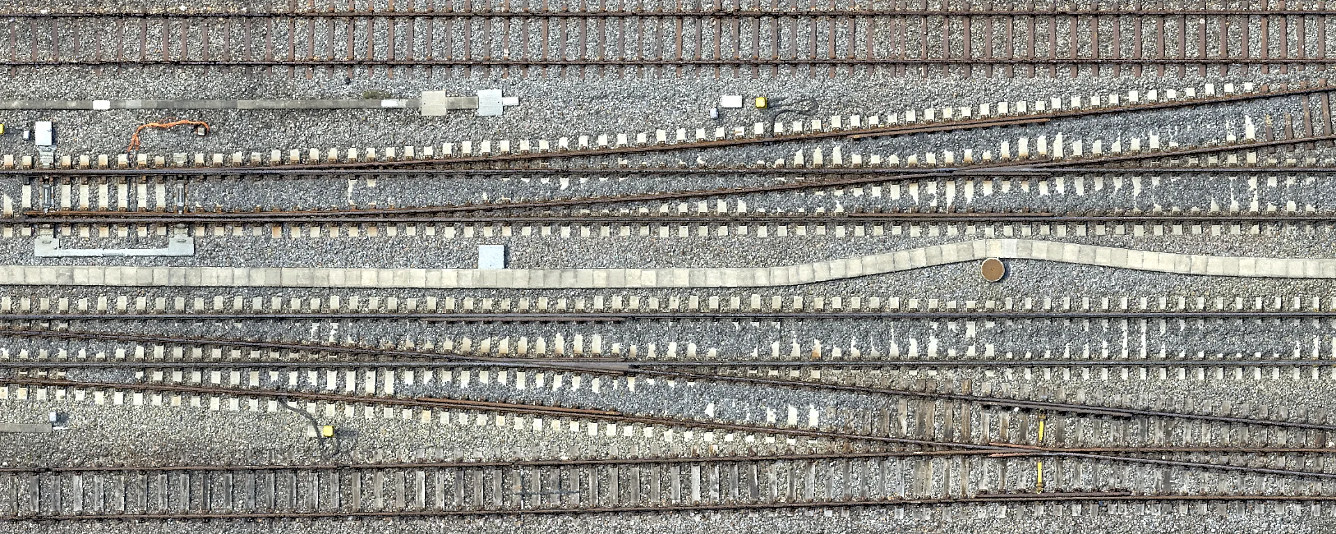
Drone Survey of Zurich Tiefenbrunnen Station
High-resolution drone survey of Zurich Tiefenbrunnen station in the LV95 SBB reference frame as a planning basis for the 2029 track renewal.
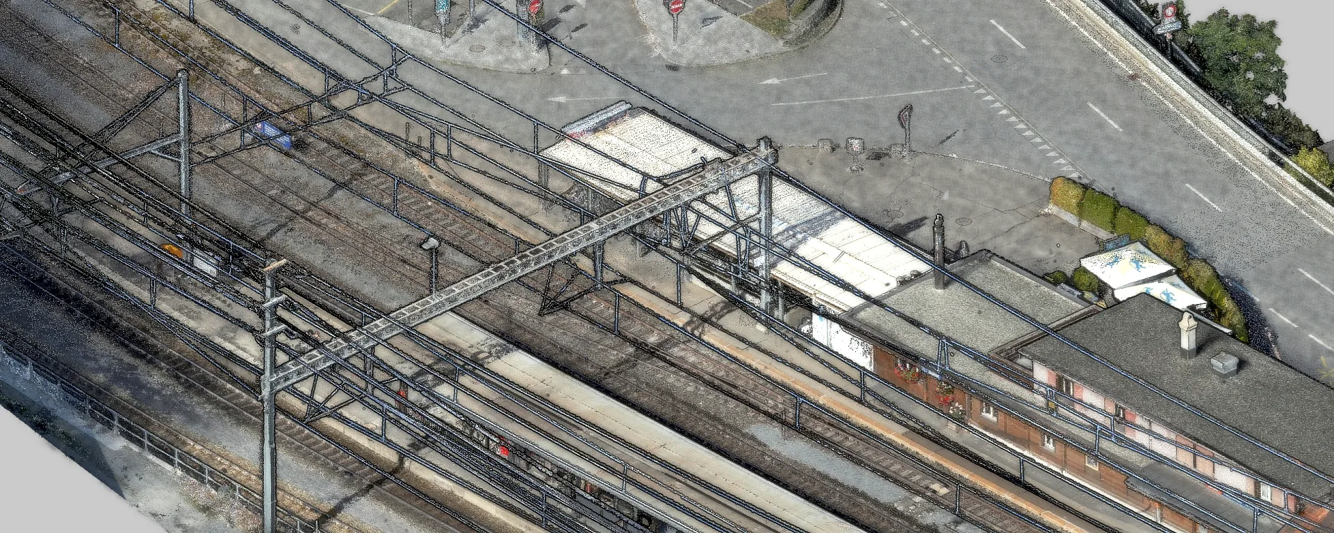
Point Cloud Fusion at Reichenau-Tamins Station
At the Reichenau-Tamins RhB station, we merged drone imagery, airborne LiDAR and terrestrial scans into one point cloud and verified its accuracy.
Frequently asked questions
When do I need LiDAR and when is photogrammetry enough?
Over open terrain, buildings and traffic areas, photogrammetry delivers very dense and coloured point clouds. As soon as the ground under vegetation, thin cables or pylons have to be captured, LiDAR has the advantage. We often combine both methods in the same project.
How does classification work?
Each point is assigned to a class based on its position, its surroundings and its colour, for example ground, vegetation, building, water, bridge or power line. Each class can then be analysed on its own, for example only the ground for a terrain model.
How large does the data get?
Point clouds are large. Depending on point density and method, even a site of a few hectares can contain several hundred million points. We therefore deliver the data tiled and, where needed, compressed, for example as LAZ, or evenly thinned to a desired number of points per square metre. If elevation models are required from the data, they can be produced from model keypoints (the ground points that describe the terrain within a specified tolerance), which reduces the data size considerably.
Can you deliver point clouds in the SBB reference frame?
Yes. On railway sites we georeference the survey data directly in the LV95 SBB reference frame using the track survey control points and additional ground control points. We document the accuracy achieved in the accuracy report.
Which data does your project need?
We advise you without obligation and show which services and which platform suit your project.