Skip to content
Applications

Applications in construction and infrastructure

Every project starts with a concrete question. Here are the most common ones, and what we deliver for them.

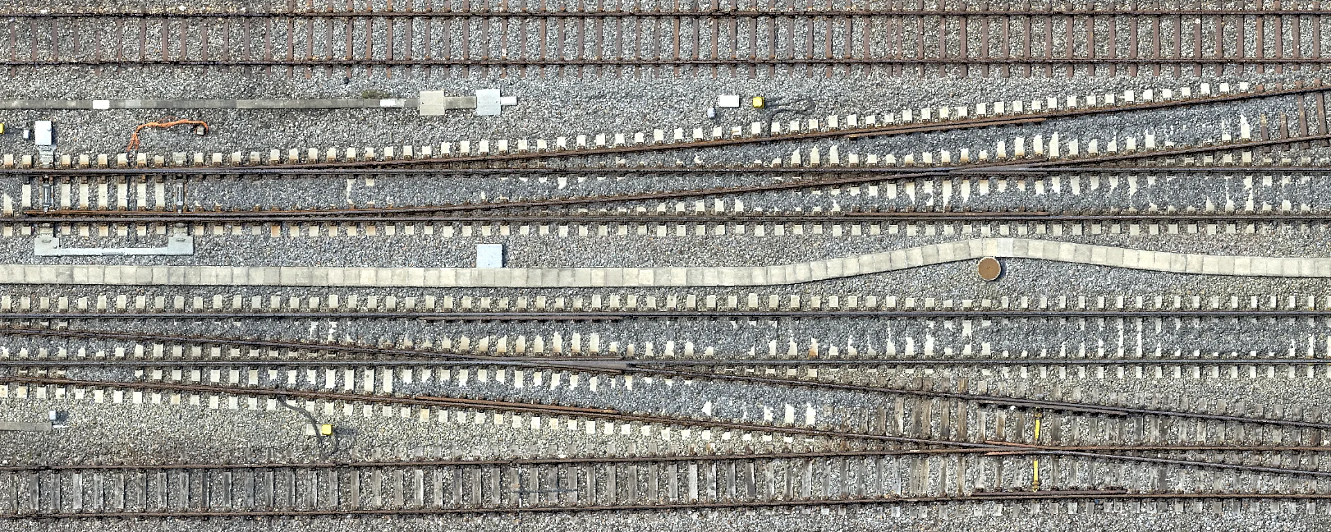
True orthophoto of the track system at Zurich Tiefenbrunnen with rails, sleepers and ballast

Capturing and planning railway sites

For upgrade and maintenance projects we capture track systems and engineering structures without contact, in the required railway reference frame such as LV95 SBB. High-precision point clouds, terrain models and true orthophotos are verified at independent check points and handed over directly to your alignment systems.

Elevation model in elevation colours with terraces, slopes and paths

Determining volumes in gravel pits and landfills

Periodic flights provide auditable proof of volumes for extraction, backfill and fill bodies on a given date. From difference models between dates we quantify the movement of material transparently and keep changes traceable over the years.

Point cloud of an overhead line corridor with two pylons, the vegetation coloured from green through orange to red by its distance to the conductors

Checking vegetation along overhead lines

From classified LiDAR point clouds we analyse the trees along high-voltage lines and detect conflicts with the defined safety clearances automatically. This serves as a planning basis for targeted cutting back and reduces the risk of supply failures.

Related services
Close-up at a high-voltage pylon with insulators, an arcing horn with traces of rust and the bolted clamps of the conductors

Inspecting bridges, pylons and facilities

High-resolution camera systems document piers, load-bearing structures and soffits that are hard to reach, as well as pylons with their insulators and bolted connections, without contact. Crack patterns, traces of corrosion and material break-outs are captured below a millimetre and provided as a georeferenced basis for damage assessment.

Related services
Orthophoto of a road surface, cracks and markings are clearly visible

Documenting roads and surfaces

High-resolution true orthophotos and point clouds capture cracking, rutting, deformation and markings with high precision, without obstructing traffic. The data form the objective basis for systematic asset management and for accepting completed works with evidence.

Related services
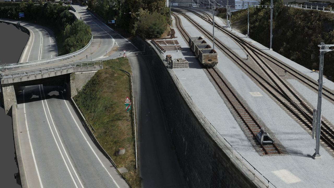
3D scene of a neighbourhood with a construction site next to the railway line

Recording construction progress

Periodic flights document the state of construction on a given date in high-resolution orthophotos, textured 3D meshes and immersive Gaussian splats. Clients, planners and contractors identify deviations from the plan early and settle the earthworks carried out transparently.

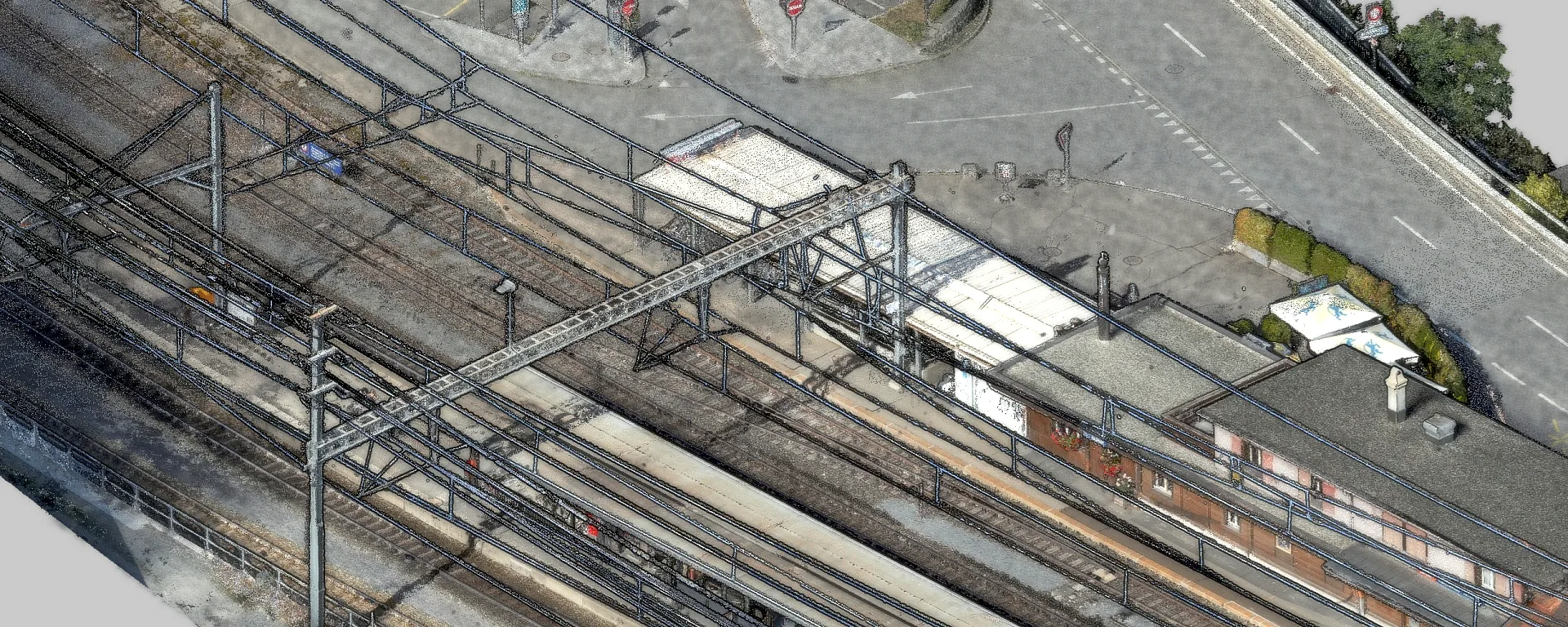
Station building with a long platform canopy and forecourt as a 3D model

As-built models of stations and operational buildings

For conversion and repair projects we merge terrestrial laser scanning and drone flights into one complete, georeferenced dataset. From it we model precise, IFC-compliant BIM and CAD models for architecture, structure, interiors and the surrounding terrain.

Related services
Why Geotrend

What you can expect from us

Sensor fusion

We combine photogrammetry and LiDAR laser scanning from drones, helicopters and terrestrial systems into one homogeneous dataset. This unites the highest spectral image resolution with dense geometric coverage of demanding objects.

Validated quality

Every project is fitted into the Swiss national network using ground control points measured by total station or GNSS and verified at independent check points. We document the accuracies achieved statistically in a transparent test report.

Legal certainty

As a certified operator we fly in the «specific» category of the Federal Office of Civil Aviation (FOCA). We take care of the entire permit management and coordinate operations in control zones and above critical infrastructure.

Data captured at the same time

Point clouds, true orthophotos, terrain models and 3D meshes come from a single coordinated flight plan. That avoids discrepancies in time between the datasets and guarantees they fit together geometrically.

Frequently asked questions

Are you allowed to fly over construction sites and railway installations?

As a certified operator we fly with an authorisation from the Federal Office of Civil Aviation (FOCA) in the «specific» category, based on SORA risk assessments. Every operation is agreed in advance with the client, the railway or grid operators and with Skyguide for flights in control zones. We obtain all official authorisations and operational clearances beforehand.

What measurement accuracy is achieved?

The accuracy that can be achieved depends on the sensor resolution, the flying height and the connection to ground control points. On demanding infrastructure projects we achieve mean deviations at independent check points of a few millimetres to less than one centimetre. We define the accuracy required for each project in advance and document the values achieved in a transparent test report.

Do you also carry out official cadastral surveying?

Sovereign tasks of official cadastral surveying are reserved for licensed surveying engineers entered in the Swiss register of surveyors. We act as a specialised technology and data partner for surveying and engineering offices and deliver high-precision aerial images, LiDAR point clouds and terrain models. The data are fitted directly into the official reference frames and cadastral systems.

In which data formats do you hand over the data?

We hand over point clouds as LAS, LAZ or E57 and true orthophotos and elevation models as georeferenced GeoTIFF or XYZ rasters. Three-dimensional building solids are provided as CAD and BIM vectors (DWG, DXF, IFC) and as 3D meshes (OBJ, FBX, 3D Tiles). We match tiling schemes and coordinate systems exactly to your target systems, including Swiss national coordinates (LV95 with LN02) and railway reference frames such as LV95 SBB.

Do you work as a subcontractor for engineering and surveying firms?

Yes. For engineering, geology and surveying firms we take on the survey flight and processing as a subcontractor. We deliver orthophotos, point clouds and elevation models in your coordinate system and format, so you can use the data directly in your project. The professional assessment and the responsibility towards the client remain with you, and on request we do not appear towards your client.

A construction or infrastructure project?

We are happy to advise you on the right services for your project.