
Conversion and renovation
Anyone converting a building needs dimensions they can rely on. The model shows walls, ceilings, openings and heights as they are today and becomes the basis for design, tender and cost estimate.
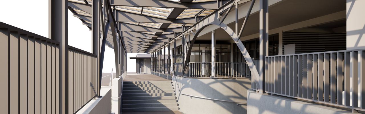
Building on existing stock requires reliable data instead of outdated archive plans. We survey buildings comprehensively from the air and from the ground and create true-to-scale as-built models for CAD and Building Information Modelling (BIM), measured with high precision rather than estimated.
An as-built model pays off wherever plans are missing, outdated or do not show what was actually built.
Anyone converting a building needs dimensions they can rely on. The model shows walls, ceilings, openings and heights as they are today and becomes the basis for design, tender and cost estimate.

Old buildings rarely have a straight wall. We model true to deformation, so leaning walls and sagging ceilings appear in the model as they were built and are not artificially straightened.

Space is tight in plant rooms and shafts. Pipes, ducts and equipment in the model show where new installations fit and where they would clash with what is already there.

On large sites, context matters. Buildings, facilities, surroundings and terrain sit in one model and in Swiss national coordinates (LV95), which makes planning, expansion and operation easier.

Rooms, areas and access matter for property management, letting and maintenance. An up-to-date model provides the basis, including when a property is bought or taken over.

The model produces visualisations that make a project understandable for clients, authorities and neighbours, in its real setting and with the surroundings from the survey flight.


You receive a complete, georeferenced as-built model that brings together the exterior, the interiors and the load-bearing structure in a uniform coordinate system and data model.

From one complete survey we derive consistent 3D models, 2D plans and visualisations.


Together with you, we decide how detailed an as-built model needs to be. The examples show the same building element in the four modelling standards, either as a 3D model or as a plan.


We define the scope, modelling standard and formats together with you for each project.
| Scope | From a single building to an entire site, inside and out, with surroundings and terrain |
|---|---|
| Source data | Surveys from the air by drone or helicopter and from the ground, registered together |
| Model | 3D CAD or BIM model, on request with building services |
| Modelling standard | From an overview model to a detailed as-built model, modelled true to deformation. The quote records which building elements are included. |
| Delivery formats | Models native for ArchiCAD, Revit, Allplan and Vectorworks or as IFC, plans as DWG, DXF and PDF |
| Coordinate system | Swiss national coordinates LV95 with LN02 or LHN95, on request another system such as LV95 SBB or WGS84 |
| Accuracy | We agree it for each project and record it in the quote. What counts is the accuracy of the model, not that of the measuring instrument. |
| Intended use | As-built models for conversion, heritage conservation, building services and operation. Only visible surfaces are captured. Heavy rain, fog and snowfall prevent outdoor surveys, and reflective surfaces can only be captured to a limited extent. |
From the first exchange to the finished geodata in your system.
Tell us the location, the size of the building and the intended use in the quote form. We incorporate existing documents directly to define the modelling standard and the scope of the project precisely.
With a drone flight we capture the roofscape and surroundings, while terrestrial laser scanners record the facades and interiors with high precision.
From the combined point clouds we create the as-built model to the agreed modelling standard, true to deformation and optimally prepared for your CAD or BIM software.
You receive the finished 3D model, derived plans and visualisations in your native software formats, correctly positioned in the Swiss reference system.
Official datasets such as swissBUILDINGS3D capture building volumes and roof shapes only schematically, with a tolerance of 30 to 50 cm and without facade details, roof structures or interiors. For precise conversions, energy-efficient renovations or reliable facility management, a survey of the current state accurate to the centimetre is essential.
An as-built model shows a real building with geometric precision in its current state. It includes walls, floor slabs, roof geometry, openings and, on request, the building services. Unlike a design draft, it is based entirely on real survey data and shows the actual building fabric.
For an indicative quote, the address of the property, the approximate size of the building including the number of storeys and the planned use are enough. Existing archive plans, sketches or photos speed up the calculation. A site visit is usually not required for the quote.
The decisive factors are the volume of the building, the complexity of the floor plans and the accessibility of the rooms. Added to this are the required modelling standard, the number of 2D plans you need and any additional services such as terrain models or building services. You receive a transparently calculated fixed-price quote for the defined scope.
We distinguish between the accuracy of the survey and the accuracy of the model. The survey with laser scanners and drones is highly accurate. For the modelling you determine the modelling standard and the permissible tolerances, which we record in the quote for each project.
By default we model true to deformation. Leaning walls, sagging ceilings or inaccuracies from the time of construction are shown exactly as they were measured. If your planning requires idealised, right-angled components, this can be agreed in advance.
Natively for leading BIM and CAD systems such as ArchiCAD, Autodesk Revit, Allplan or Vectorworks and in the neutral Industry Foundation Classes (IFC) standard. We deliver derived 2D plans as DWG, DXF and PDF.
Sensors capture the visible surfaces. Hidden layer structures of walls, cavities or pipes inside components cannot be seen with measuring methods. Such information requires selective structural investigations on site.
From the ground, roof surfaces, roof structures and the adjacent topography often remain hidden. By combining a drone flight with a terrestrial scan, we bring together the roofscape, facade alignments and interiors in a shared, correctly positioned coordinate system.
We advise you without obligation and show which services and which platform suit your project.