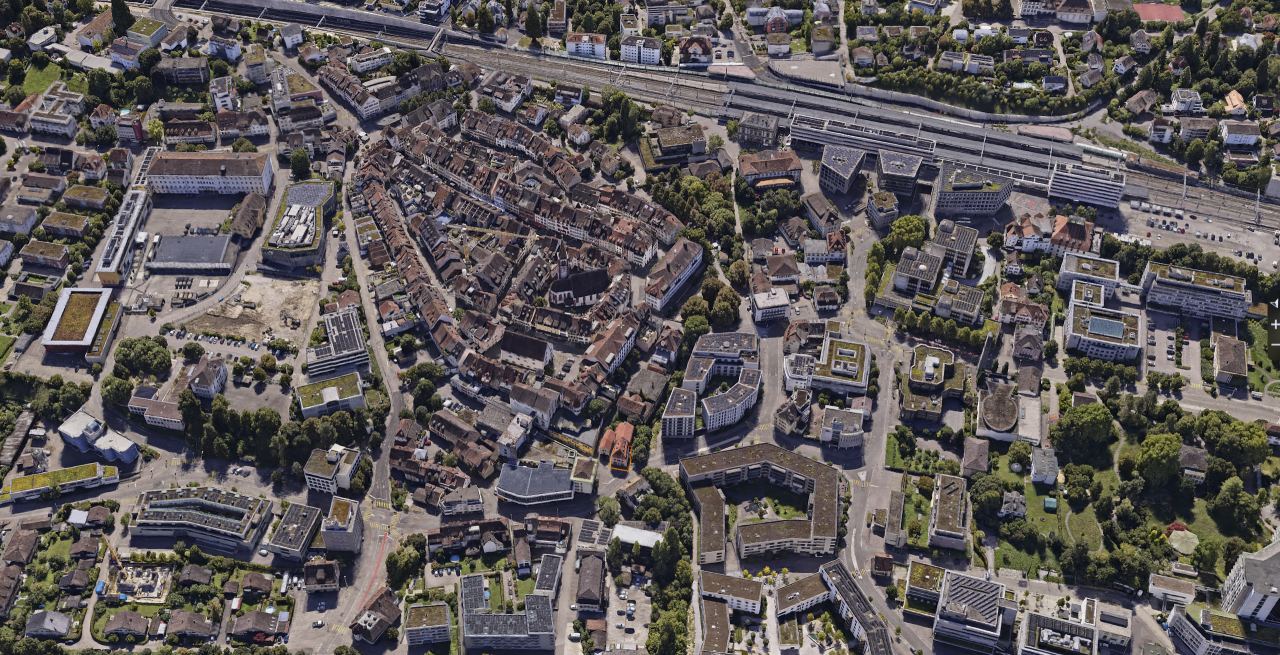
Photorealistic 3D scenes for planning and dialogue
With 3D Gaussian splatting we transform high-resolution aerial images into a freely navigable 3D scene. Buildings, dense vegetation and the finest structures retain their natural spatial depth and are reproduced exactly as they appear on site.
Key facts
What Gaussian splats are good for
Gaussian splats convey the environment as intuitively as reality itself. They create the perfect basis for public participation, presentations and open dialogue with decision-makers.
Public participation and information
A planned project can be shown in its real surroundings, which is easy to understand even without experience in reading plans. This helps at information evenings, in participation procedures and at municipal assemblies.
A good fit for Government & AuthoritiesPresenting sites
Investors, juries and decision-making bodies see a site from every angle instead of piecing together a picture from plans and individual photos.
A good fit for Tourism, Marketing & MediaTourism and location marketing
A village centre, a viewpoint or a company site becomes a digital experience for a website, a trade fair or an exhibition.
A good fit for Tourism, Marketing & MediaRecording a condition
A splat shows what a site looked like at a given moment, for example before a conversion. For dimensions and areas, you use the 3D mesh or the point cloud from the same flight.
A good fit for Construction & Infrastructure3D structural inspection
High-resolution flights around radio masts, transmitter towers or bridges allow detailed condition analyses directly in the 3D model. Damage, connections and structural details can be checked with high precision from any perspective on screen, safely and without scaffolding.
A good fit for Construction & InfrastructureImpressions from our projects


What you receive from us
We deliver photorealistic 3D data that fits seamlessly into your existing workflows and geodata, based on a single, efficient image flight.
- Georeferenced 3D scene: your perimeter as a Gaussian splat, fitted exactly into the coordinate system of your choice.
- Combined datasets: on request we also create conventional textured 3D meshes and high-resolution orthophotos from the same flight.
- Integration advice: we help you choose suitable web viewers or platforms for a smooth presentation.
Technical details
We define the parameters together with you for each project.
| Source data | High-resolution nadir and oblique aerial images, optionally supported by LiDAR, captured by drone or helicopter |
|---|---|
| Perimeter size | From a highly accurate splat for inspecting individual objects to large-scale sites |
| Georeferencing | Fitted into national and local reference systems (e.g. LV95), seamlessly compatible with your geodata |
| Delivery formats | Standard web and 3D formats (e.g. 3D Tiles, PLY, SPZ) for viewers, web GIS and platforms such as Cesium or ArcGIS |
| Intended use | Photorealistic visualisation and interactive walk-throughs. For precise measurements and CAD modelling we additionally deliver a 3D mesh or point clouds. |
How a project works
From the first exchange to the finished geodata in your system.
-
Advice and quote
Draw your project area directly in the quote form or describe your requirements. Together we define the optimal resolution and the scope of services for your project.
-
Planning and flight
We match flight pattern, overlap and ground sampling distance precisely to the required target accuracy. Data is captured efficiently with our professional flight and sensor technology.
-
In-house processing
Aerial triangulation, classification and 3D modelling run entirely on our own high-performance computers. Even large perimeters with tens of thousands of images are processed with complete consistency and reproducibility.
-
Delivery and proof
You receive ready-to-use geodata, tailored exactly to your coordinate system, your software and your tiling requirements, including transparent proof of accuracy.
When Gaussian splats are the right choice
Splats and 3D meshes are based on the same image data but serve different purposes. While the 3D mesh provides a geometrically closed, measurable surface for CAD and GIS, the Gaussian splat impresses with the most natural visual appearance for vegetation, fine structures and reflective surfaces.
Well suited
- A project needs to become immediately understandable and tangible for clients, authorities or the public.
- The realistic overall impression and immersion matter more than pure measurement functions.
- The site contains dense vegetation, glass facades or delicate structures that lead to distortions in a conventional 3D mesh.
Less suited
- Exact dimensions, areas or volume calculations are required, for which conventional 3D meshes and point clouds are suitable.
- The data is to serve directly as a basis for design or modelling.
- The target application or the existing GIS does not yet support the integration of Gaussian splats.
Reference projects
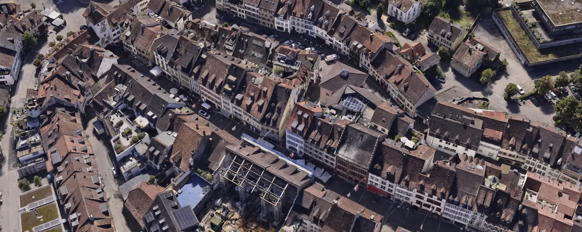
3D Mesh in LUUCY and icRoom for the City of Liestal
3D mesh for urban planning in Liestal. Thanks to a custom LoD workflow, the model runs live at 60 fps in the icRoom projection.
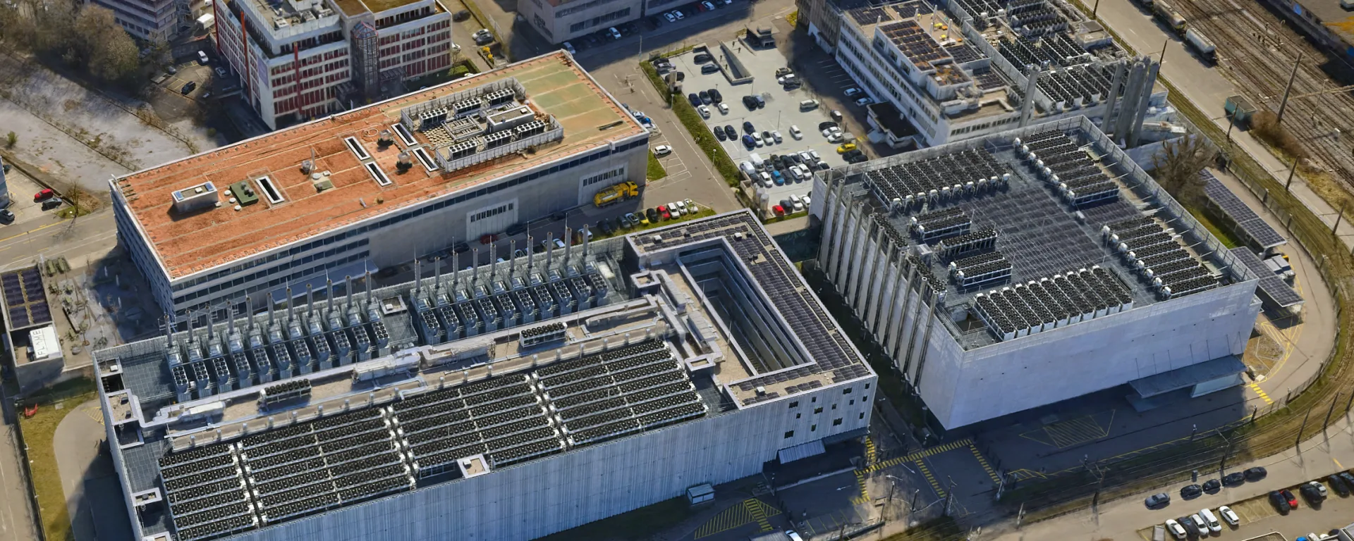
3D Mesh for the Urban Development of Opfikon
Aerial data for urban development in Opfikon, flown by helicopter just 700 m from the runway at Zurich Airport, closely coordinated with Skyguide.
Frequently asked questions
What is a Gaussian splat?
A 3D Gaussian splat is made up of millions of tiny elliptical particles, each positioned in space. Combined, these points form a continuous 3D scene that reproduces light, reflections and viewing angles true to life. The method is currently regarded as the leading technology for freely explorable, photorealistic real-time visualisations.
Can you measure in a splat?
Only to a limited extent. The scene is georeferenced with high accuracy, but the focus is on visual communication. For reliable distance, area or volume measurements we deliver conventional 3D meshes or classified point clouds with transparent proof of accuracy from the same image flight. On request, both worlds can also be used in combination.
How does a splat differ from a 3D mesh?
A 3D mesh forms a fixed geometric surface of triangles with a photographic texture, ideal for sections and for analyses in CAD and GIS. A Gaussian splat models the site with volumetric particles instead of a rigid polygon grid. This avoids the typical distortions of a 3D mesh, and fine elements such as fences, vegetation or glass surfaces look visually flawless.
Where can Gaussian splats be shown?
We deliver the data to suit your environment. It comes as a lightweight web scene for simple browser presentations or as georeferenced 3D Tiles for geoportals built with Cesium and professional GIS environments such as ArcGIS Pro.
Which data does your project need?
We advise you without obligation and show which services and which platform suit your project.