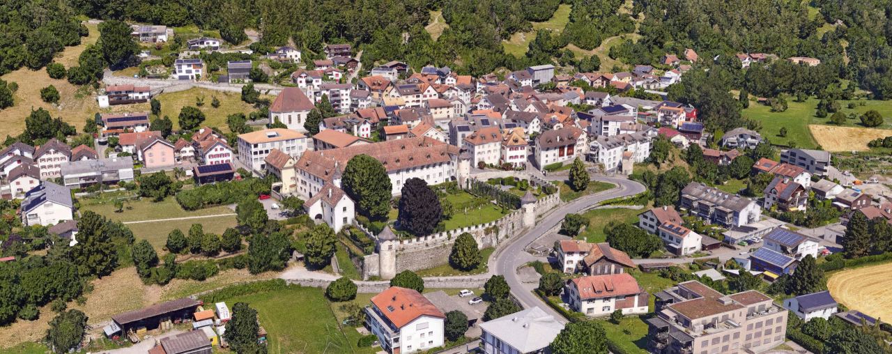
3D meshes from individual objects to entire cities
A textured 3D mesh represents terrain and buildings as a closed, precisely measurable surface of triangles with a photorealistic texture. It serves as a reliable geometric basis for demanding analyses, city models and seamless workflows in CAD and GIS environments.
Key facts
What you use 3D meshes for
Textured 3D meshes combine precise geometry with a photorealistic texture, the ideal shared data basis for planning, visualisation and decisions.
3D city model and digital twin
An up-to-date 3D mesh is the shared basis for planning and administration. Integrated into the geoportal, it creates transparency as a reliable source of information for specialist departments and the public.
A good fit for Government & AuthoritiesPlanning in the real surroundings
New buildings, roads and open spaces are assessed directly in the model of today's surroundings. Volumes from planning platforms can be imported and shown in their real setting.
A good fit for Government & AuthoritiesCompetitions and studies
A detailed 3D mesh of the perimeter guarantees all participating firms the same precise planning basis. Juries and expert panels compare the designs directly in true-to-scale, three-dimensional surroundings.
A good fit for Tourism, Marketing & MediaLocation marketing and communication
As an interactive web scene, the 3D mesh lets people experience neighbourhood developments and projects in the browser. Without installing any software, investors and interested parties get a vivid impression of the entire site.
A good fit for Tourism, Marketing & MediaExisting buildings and sites
Roofs, facades and outdoor facilities are documented completely and with geometric precision. The data forms the foundation for conversions, structural maintenance and condition analyses, and you take dimensions and areas directly from the model.
A good fit for Construction & InfrastructureImpressions from our projects


What you receive from us
For a 3D mesh we fly the area vertically and obliquely, so that the facades are also fully captured.
- Textured 3D mesh: photorealistic, with hierarchical levels of detail (LoD) and tiling for smooth rendering in desktop and web applications
- Radiometric true orthophoto: orthorectified aerial image from the same block of images, calculated without building lean and with every street axis clearly visible
- Web and GIS compatibility: optimised data packages as Cesium 3D Tiles, Esri Scene Layer Package (SLPK) and OBJ or FBX formats for 3D GIS, BIM and city models
- Validated accuracy report: documentation of the statistical horizontal and vertical deviations, based on independent check points
Technical details
We define the parameters together with you for each project.
| Texture resolution | Selectable for each project, typically 1 to 4 cm per pixel for city and neighbourhood projects |
|---|---|
| Accuracy | Verified at independent check points and documented transparently in the accuracy report as the root mean square error (RMSE) |
| Perimeter size | Scalable from a single building through neighbourhoods to entire urban areas |
| Source data | High-resolution nadir and oblique aerial images, optionally supported by laser scanning (LiDAR), captured by drone or helicopter |
| Structure | Spatial tiling as specified, multiple levels of detail (LoD) and adaptive texturing depending on the type of object |
| Delivery formats | Standardised web and GIS formats such as Cesium 3D Tiles and the scene layer package (SLPK) for ArcGIS, common 3D formats such as OBJ, FBX, glTF and GLB, and CAD and BIM formats such as DWG, DXF or IFC |
| Coordinate system | Swiss national coordinates (LV95 with LN02 or LHN95), railway-specific (LV95 SBB) or global systems such as WGS84 |
How a project works
From the first exchange to the finished geodata in your system.
-
Advice and quote
Draw your project area directly in the quote form or describe your requirements. Together we define the optimal resolution and the scope of services for your project.
-
Planning and flight
We match flight pattern, overlap and ground sampling distance precisely to the required target accuracy. Data is captured efficiently with our professional flight and sensor technology.
-
In-house processing
Aerial triangulation, classification and 3D modelling run entirely on our own high-performance computers. Even large perimeters with tens of thousands of images are processed with complete consistency and reproducibility.
-
Delivery and proof
You receive ready-to-use geodata, tailored exactly to your coordinate system, your software and your tiling requirements, including transparent proof of accuracy.
When a dedicated 3D mesh makes sense
Publicly available geodata and cantonal aerial images quickly reach their limits in terms of detail and currency. With update cycles of several years and purely vertical images, current construction states and oblique views that show facades sharply are often missing. Anyone who needs facades, topography and the real street space in three dimensions and as they are today benefits from a dedicated project survey flight.
Well suited
- The model should look like reality, with facades, trees and streetscape.
- You need the current state, for example for ongoing planning or a participation procedure.
- The model should perform well and be smoothly navigable in a web viewer, in room projections or in geoportals.
Less suited
- Schematic building volumes or simple models are already enough for an initial volume study.
- You need a model structured by building with roof shapes. That is what our city models are for.
Reference projects
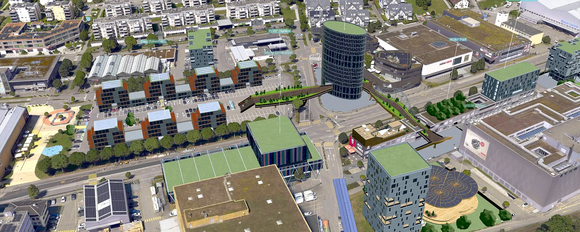
3D Mesh for the Vision (WiVo*) of the City of Volketswil
High-performance 3D mesh powering the 3D viewer of the WiVo* location development initiative in Volketswil.
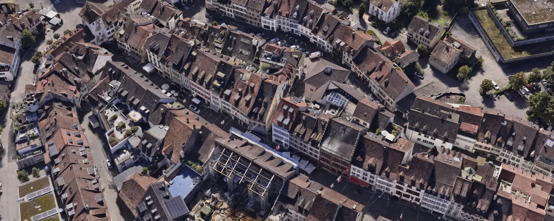
3D Mesh in LUUCY and icRoom for the City of Liestal
3D mesh for urban planning in Liestal. Thanks to a custom LoD workflow, the model runs live at 60 fps in the icRoom projection.
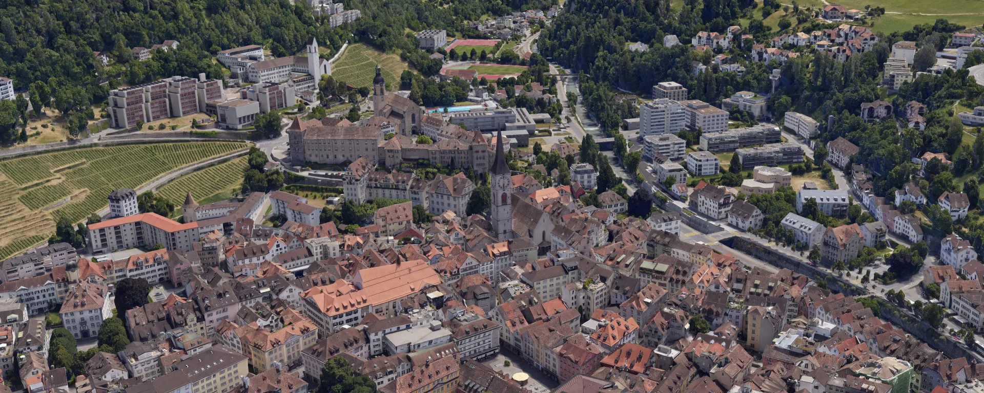
Orthophoto and 3D Mesh for the City of Chur
The city of Chur keeps its geodata up to date. Orthophoto and 3D mesh from a helicopter survey, freely accessible to everyone in the 3D city map.
Frequently asked questions
How large can the area be?
There is practically no upper limit. Depending on the project perimeter and the required resolution, we use drones, helicopters or aeroplanes. For large perimeters we capture entire municipalities and valleys from several tens of thousands of images. Thanks to spatial tiling and adaptive levels of detail (LoD), even large city models remain smoothly navigable in the browser and in GIS at all times.
Does the model also run in the browser?
Yes, completely smoothly. We prepare the 3D meshes for modern web streaming, by default as 3D Tiles of the Open Geospatial Consortium (OGC) for Cesium or as a scene layer package (SLPK) for ArcGIS Online and Portal. Viewers can move through the entire model directly in the web browser, without installing software and without long loading times.
Can I use the model in CAD or BIM?
Yes. For CAD and visualisation environments we export the triangle meshes in standardised formats such as OBJ, FBX or glTF, tile by tile where needed for resource-efficient processing. For BIM and planning programs we provide sections, terrain models or volume-based derivatives in formats such as DXF, DWG or IFC on request.
What is the difference between a 3D mesh, a point cloud and a BIM model?
A point cloud consists of millions of individual measured points with position and colour. It is the most accurate raw form but has no closed surface. A 3D mesh connects the points into a closed, textured surface of triangles that looks photorealistic and can be displayed smoothly in the browser, in GIS and in visualisations. A BIM model, by contrast, consists of building components such as walls, floors and roofs with their properties. It is modelled from surveys from the air and from the ground, which is our building modelling service.
Which data does your project need?
We advise you without obligation and show which services and which platform suit your project.