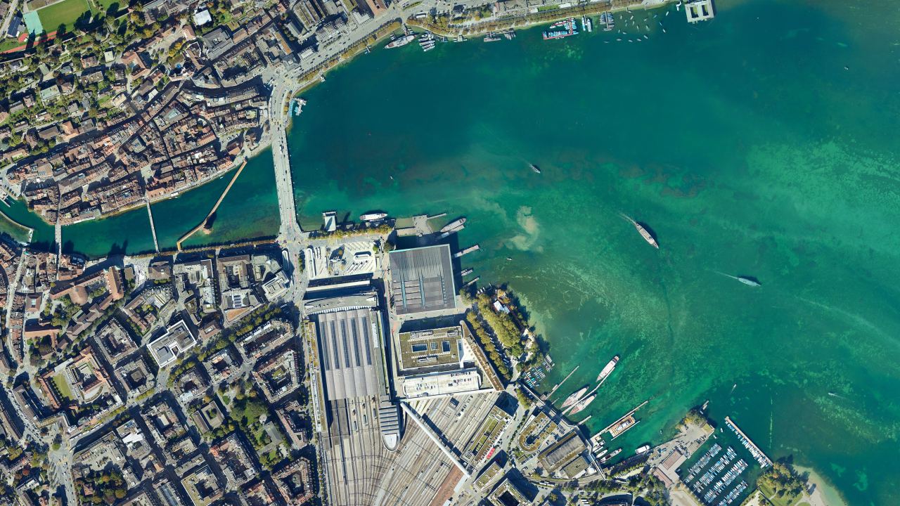
Up-to-date orthophotos, true to scale and accurately positioned
A digital orthophoto combines the wealth of detail of an aerial image with the dimensional accuracy of a map. Depending on the requirements of the project, we rectify conventionally onto a terrain model or deliver true orthophotos free of building lean based on a detailed surface model, directly measurable in GIS and CAD.
Key facts
What you use orthophotos for
Digital orthophotos form the dimensionally accurate visual basis for geographic information systems. They combine topographic precision with current image content for planning, administration and asset preservation.
Planning basis for construction projects
Up-to-date orthophotos document the actual situation before construction starts, with utility covers, road markings and pavement boundaries, as a dimensionally accurate design basis for planners.
A good fit for Construction & InfrastructureGeoportals for cities and municipalities
Orthophotos are a reliable basis for municipal geodata services. Regular survey flights keep web GIS and citizen portals up to date and serve specialist departments and the public as a neutral reference.
A good fit for Government & AuthoritiesInfrastructure and track inspection
Sub-centimetre resolutions make pavement damage, track systems and cracks in structures visible without contact, without closing traffic routes or walking along the tracks on site.
A good fit for Construction & InfrastructureVegetation and environment
Colour infrared data (CIR) from the same flight provide objective indicators for plant vitality, tree crown inventories and the detection of drought stress in landscape planning.
A good fit for Environment & NatureEvidence documentation and construction progress
Dated survey flights document the condition of structures before, during and after construction phases or natural events in a dimensionally accurate and historically traceable way.
A good fit for Construction & InfrastructureSpecial flights at night and in winter
Targeted survey flights at night and in snow extend conventional geodata. RGB and thermal night orthophotos are used to create light emission inventories and to analyse urban heat islands. Winter imagery with snow cover or without foliage provides a precise basis for winter sports infrastructure, avalanche prevention and forestry.
A good fit for Government & AuthoritiesImpressions from our projects


What you receive from us
On request, one flight produces several orthophotos with the same time stamp. The slider shows the same area in natural colour and in colour infrared.
- RGB true orthophoto: radiometrically calibrated, georeferenced true orthophoto in natural colour, without building lean
- CIR orthophoto: on request, a colour infrared true orthophoto (CIR) for vegetation and soil sealing analyses
- Data prepared to your needs: tile grid, format and reference system exactly as you require
- Proof of accuracy: transparent accuracy report with a statistical analysis of the surveyed ground control and check points

 RGB
CIR
RGB
CIR
Technical details
We define the parameters together with you for each project.
| Source data | High-resolution photo flights with calibrated full-frame and medium-format cameras by drone, helicopter or aeroplane |
|---|---|
| Ground sampling distance (GSD) | Scalable, millimetre GSD by drone, 2 to 5 cm by helicopter and large areas by aeroplane |
| Accuracy | Highly accurate georeferencing, independently verified at check points and documented in the accuracy report |
| Image types and bands | True ortho and conventional orthophoto in natural colour (RGB), colour infrared (CIR) and 4-band combinations (RGBI) |
| Perimeter size | Flexible, from a single building site to linear corridors and entire municipalities and cantonal areas |
| Delivery formats | Georeferenced raster formats such as GeoTIFF, Cloud Optimized GeoTIFF (COG), ECW and JPEG 2000, as well as image tiles with world file (TFW) |
| Coordinate system | Swiss national coordinates (LV95 with LN02 or LHN95), railway-specific (LV95 SBB) or global systems such as WGS84 and UTM |
How a project works
From the first exchange to the finished geodata in your system.
-
Advice and quote
Define your project area directly in the quote form. Together we determine the ideal ground sampling distance (GSD), the timing of the flight and the optimal scope of services.
-
Flight planning and survey flight
We match flight pattern, overlap and sensors exactly to the required target accuracy. Capture takes place on schedule and efficiently by drone, helicopter or aeroplane.
-
In-house processing
Aerial triangulation, classification and 3D modelling run entirely on our own high-performance computers. Even large perimeters with tens of thousands of images are processed with complete consistency and reproducibility.
-
Delivery and proof
You receive ready-to-use raster data in your coordinate system, tiled to suit GIS and CAD, including an accuracy report with a statistical check of the ground control and check points.
When a dedicated survey flight pays off
With SWISSIMAGE, the Federal Office of Topography swisstopo provides a high-quality nationwide orthophoto. With a ground sampling distance of 10 cm in the lowlands and a three-year update cycle, it reliably depicts large-scale overviews. For high-precision as-built surveys, evidence documentation on a specific date or true orthos free of building lean, only a project-specific survey flight delivers the required planning certainty.
Well suited
- You need the current situation, after severe natural events or for verifiable construction billing.
- The finest infrastructure details such as manhole covers, markings, cracks in the road surface or sleeper heights must be clearly recognisable.
- Highly accurate georeferencing is critical so that the orthophoto can serve directly as a reliable planning basis and for quantity surveys.
- You require an up-to-date depiction of dense development free of building lean, or simultaneous CIR bands for vegetation and soil sealing analyses.
Less suited
- For wide-ranging spatial planning studies that do not require the construction status of the day, the SWISSIMAGE base dataset is entirely sufficient.
- You are examining the built development of past decades, for which the historical Journey Through Time by swisstopo is the right tool.
Reference projects
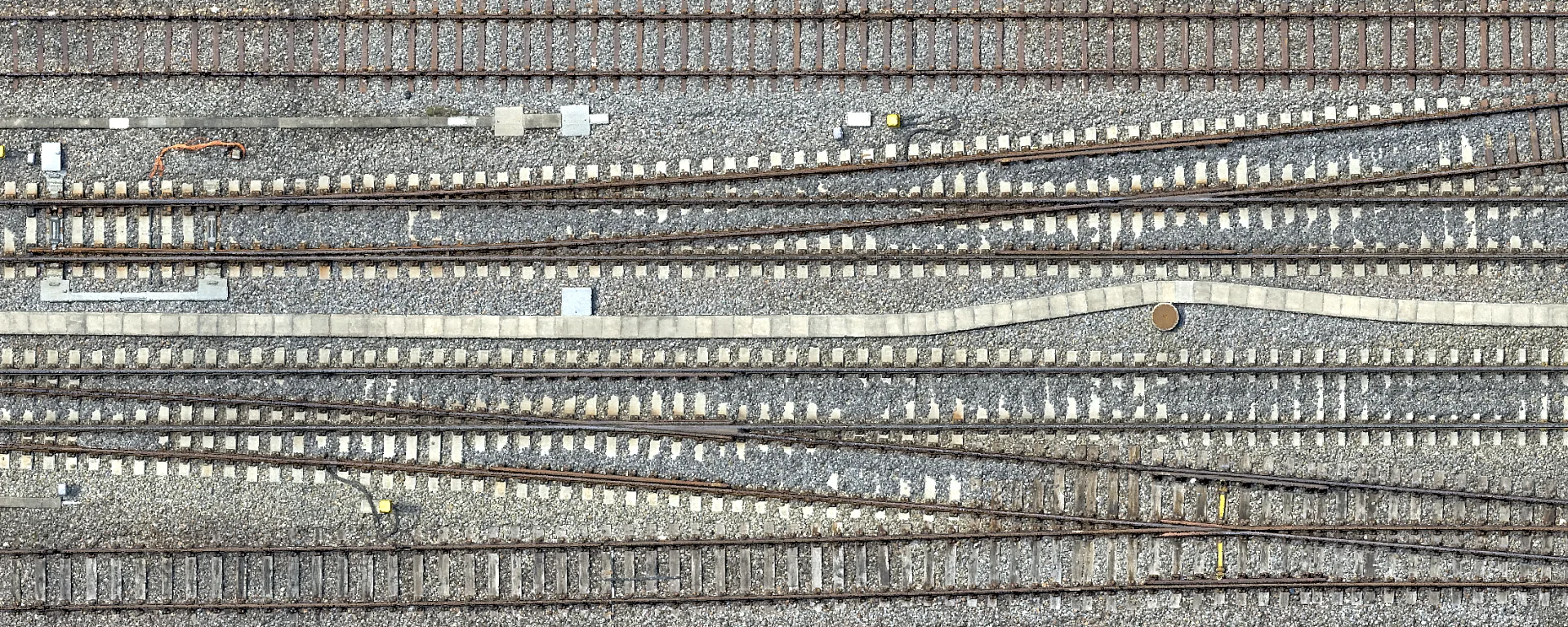
Drone Survey of Zurich Tiefenbrunnen Station
High-resolution drone survey of Zurich Tiefenbrunnen station in the LV95 SBB reference frame as a planning basis for the 2029 track renewal.
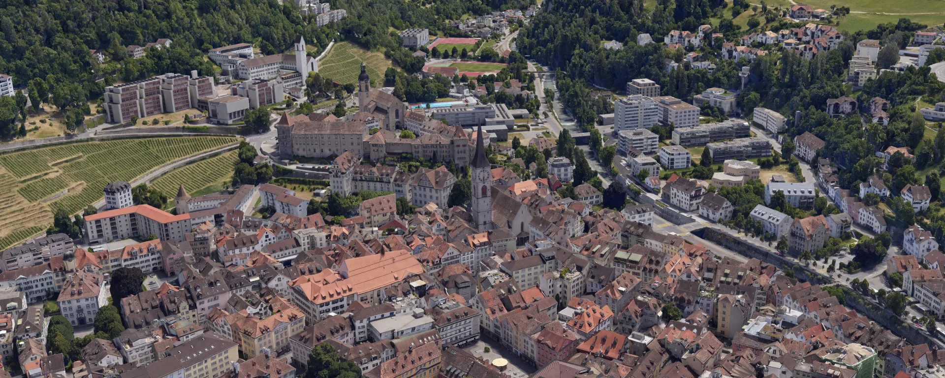
Orthophoto and 3D Mesh for the City of Chur
The city of Chur keeps its geodata up to date. Orthophoto and 3D mesh from a helicopter survey, freely accessible to everyone in the 3D city map.
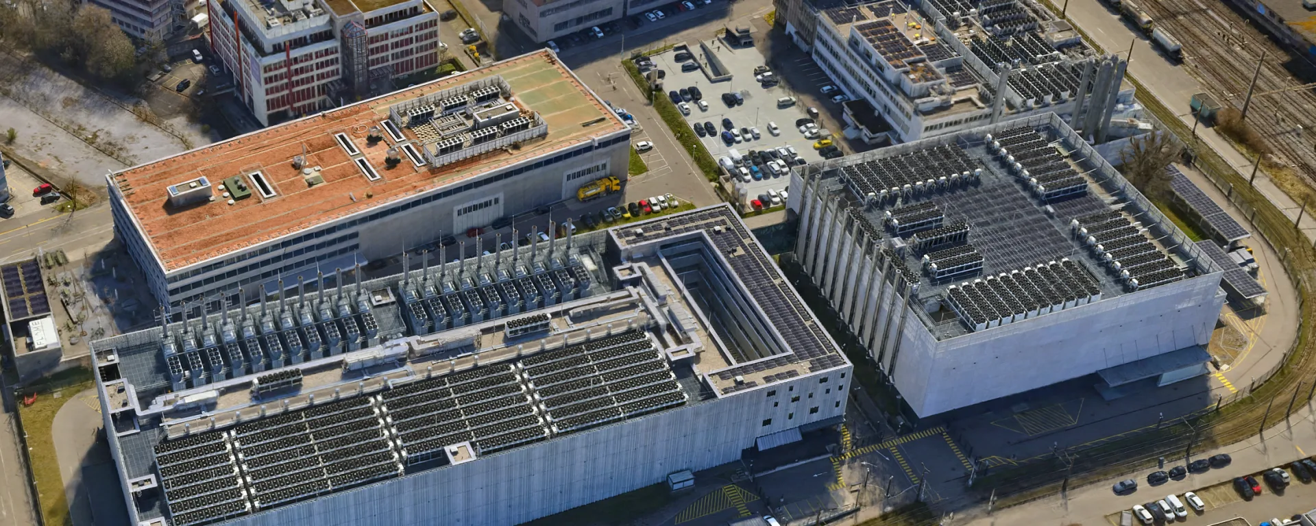
3D Mesh for the Urban Development of Opfikon
Aerial data for urban development in Opfikon, flown by helicopter just 700 m from the runway at Zurich Airport, closely coordinated with Skyguide.
Frequently asked questions
What is the difference between an orthophoto and a true orthophoto?
In an ordinary orthophoto the terrain is rectified, but tall objects such as buildings or trees appear slightly tilted and hide what lies behind them. In a true orthophoto these objects are also shown in their correct position, the roof edges lie exactly above the walls. This requires many overlapping images and an accurate surface model from the same flight.
Which ground sampling distance do I need?
The ground sampling distance (GSD) indicates how large one pixel is on the ground. A few centimetres are enough for an overview of a municipality, while details on a construction site or on track systems require millimetres. The finer the resolution, the lower the flight and the larger the data volumes. We recommend the resolution your task really needs.
How accurate is an orthophoto?
That depends on the ground sampling distance, the ground control points and the terrain. We align every project to surveyed ground control points and check the result at independent check points. With a high ground resolution we achieve deviations in the centimetre range and below, and the values are always stated in the accuracy report.
At what time of year do you fly?
We fly all year round according to your schedule. Standard survey flights for planning and GIS preferably take place when the sun is high, between spring and early autumn. On request, we also capture your area in the winter months without foliage or with a closed snow cover, for example for piste and avalanche documentation, winter sports concepts or forest mapping.
Do you also offer night orthophotos?
Yes. Using camera systems with very high light sensitivity, we produce georeferenced night orthophotos to document artificial light emissions, street lighting concepts and light pollution inventories. In combination with thermal sensors, urban heat islands, night-time overheating and heat losses can be located precisely. Because darkness places particular demands on exposure and flight dynamics, this requires adapted flight parameters as well as specially equipped helicopter platforms and special permits for night-time flights with unmanned aerial vehicles (UAV).
Which data does your project need?
We advise you without obligation and show which services and which platform suit your project.