Terrain and surface models for planning, volumes and natural hazards
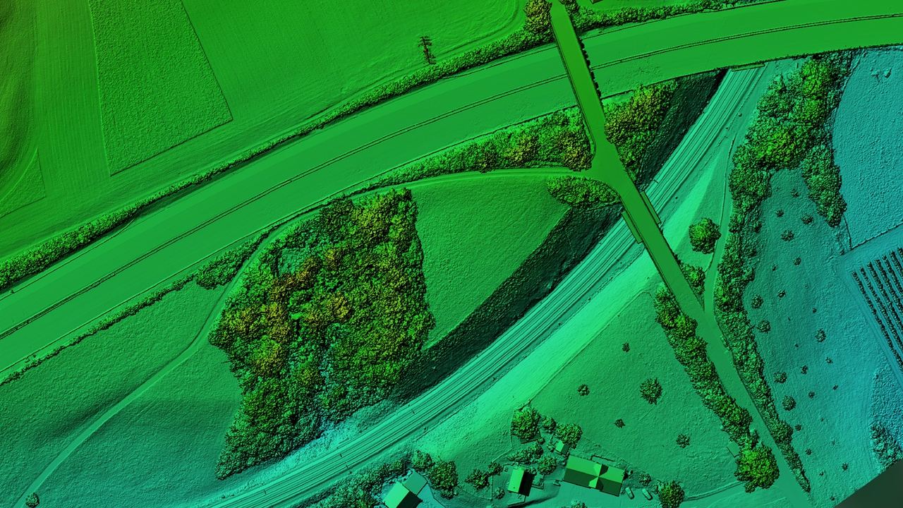
An elevation model describes the shape of the earth's surface as a dense grid of height values. We deliver the terrain model without vegetation and buildings as well as the surface model with everything that stands on the ground.
Key facts
What you use elevation models for
Elevation models are the basis for every question about shape, gradient and volume.
Earthworks and volume calculation
From elevation models we determine exact excavation, extraction and stockpile volumes for landfills, gravel pits and large construction sites. Comparisons between different dates keep the billing transparent and easy to follow.
A good fit for Construction & InfrastructureNatural hazards and events
After rockfalls, landslides or debris flows, difference models quantify the volume of material moved and the deformation of the terrain. They serve geologists and engineers as a basis for hazard maps and remediation measures.
A good fit for Environment & NatureRoute design and detailed design
High-resolution digital terrain models (DTM) provide the geometric basis for civil engineering, road design and utility planning. They allow longitudinal and cross profiles and gradient analyses to be derived automatically and handed over directly to CAD and GIS systems.
A good fit for Construction & InfrastructureHydrology and drainage
Detailed terrain models define flow paths, depressions and watersheds. They are the decisive data basis for heavy rainfall analyses, hydrodynamic 2D runoff simulations and flood protection projects.
A good fit for Environment & NatureHeights of structures and vegetation
The difference between the surface model and the terrain model yields a normalised surface model (nDSM). It allows tree heights, crown structures, building heights and clearances to overhead line corridors to be determined automatically.
A good fit for Environment & NatureImpressions from our projects


What you receive from us
Which method fits depends on the terrain. Photogrammetry is sufficient over open ground, under forest you need LiDAR.
- Digital terrain model (DTM): the cleaned and interpolated ground relief
- Digital surface model (DSM): the complete real surface as captured
- Difference models (DEM of difference, DoD): height comparisons between two dates that quantify excavation, removal or fill volumes automatically, with a transparent volume balance.
- Geometric derivatives: analytical hillshades, contour lines, slope maps and longitudinal and cross profiles according to your specifications.
- Proof of accuracy: a detailed report with a statistical error analysis based on independently surveyed check points.
Technical details
We define the parameters together with you for each project.
| Grid spacing | Freely selectable, from 1 to 5 cm for detailed and structural analyses up to standard grids such as 0.25 m, 0.5 m or 1 m for large areas |
|---|---|
| Source data | High-resolution photo flights (photogrammetry) or multi-echo LiDAR by drone and helicopter, combined with terrestrial laser scanning where needed |
| Accuracy | Accurate to the centimetre in the Swiss national network, independently verified at ground control and check points and documented in the test report |
| Coordinate system | Swiss national coordinates (LV95 with LN02 or LHN95), railway-specific (LV95 SBB) and international systems such as WGS84 and UTM |
| Model variants | Digital terrain model (DTM), digital surface model (DSM), difference models (DoD) and normalised vegetation heights (nDSM) |
| Delivery formats | GeoTIFF, Cloud Optimized GeoTIFF (COG), ASCII grid and XYZ for GIS and simulations, contour lines and break lines as DWG, DXF or GeoPackage |
How a project works
From the first exchange to the finished geodata in your system.
-
Advice and quote
Draw your project area directly in the quote form or describe your requirements. Together we define the optimal resolution and the scope of services for your project.
-
Planning and flight
We match flight pattern, overlap and ground sampling distance precisely to the required target accuracy. Data is captured efficiently with our professional flight and sensor technology.
-
In-house processing
Aerial triangulation, classification and 3D modelling run entirely on our own high-performance computers. Even large perimeters with tens of thousands of images are processed with complete consistency and reproducibility.
-
Delivery and proof
You receive ready-to-use geodata, tailored exactly to your coordinate system, your software and your tiling requirements, including transparent proof of accuracy.
When a dedicated elevation model makes sense
With swissALTI3D, the Federal Office of Topography swisstopo provides a nationwide terrain model with a grid spacing of 0.5 m free of charge. For general overviews and large-area preliminary studies it is a reliable basis. For fast-moving construction projects, precise volume calculations or recent natural events, however, its six-year update cycle and height deviations of up to several decimetres in the Alps reach their limits.
Well suited
- You need volumes and quantities accurate to a few centimetres.
- The terrain has changed, for example through construction work, extraction or a natural event.
- Fine structures such as slope edges, ditches or walls have to be captured.
- The results should remain comparable over years with the same method.
Less suited
- A rough terrain shape is enough, for example for an initial site assessment.
- The area is unchanged and the accuracy of swissALTI3D is sufficient for your question.
Reference projects
Drone Survey of Zurich Tiefenbrunnen Station
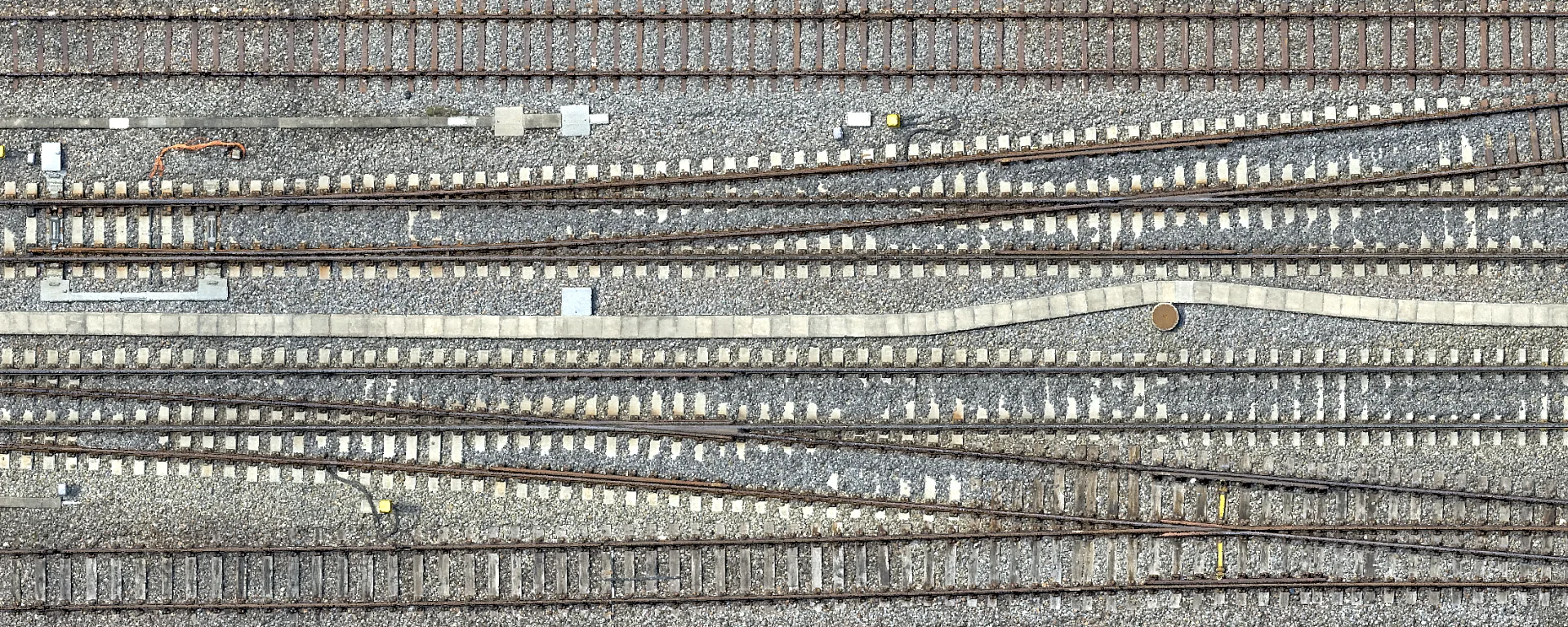
High-resolution drone survey of Zurich Tiefenbrunnen station in the LV95 SBB reference frame as a planning basis for the 2029 track renewal.
Point Cloud Fusion at Reichenau-Tamins Station
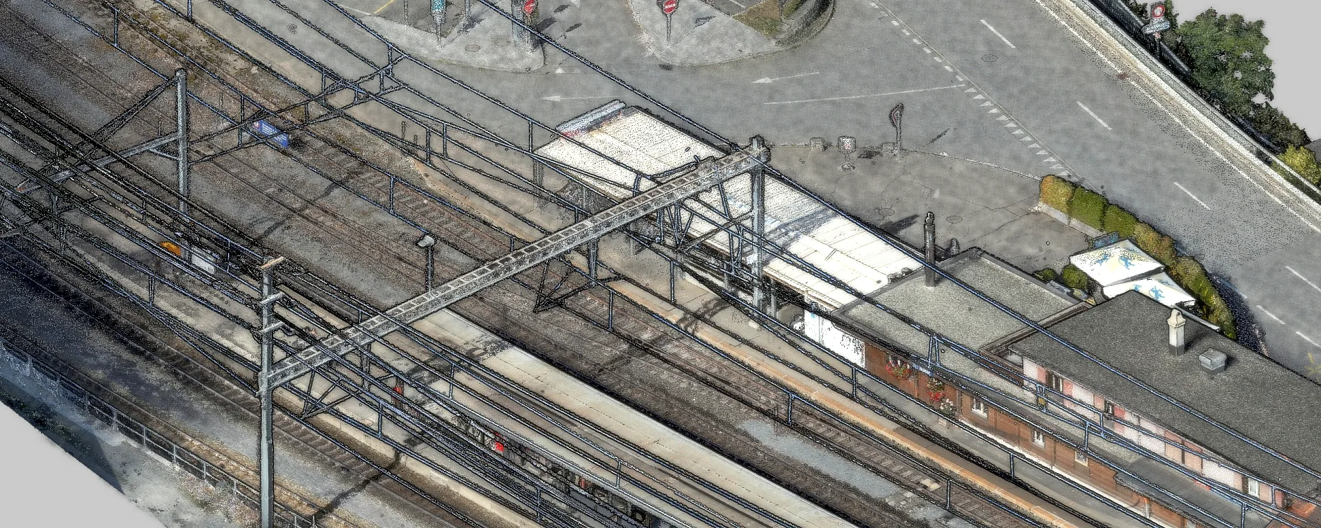
At the Reichenau-Tamins RhB station, we merged drone imagery, airborne LiDAR and terrestrial scans into one point cloud and verified its accuracy.
Frequently asked questions
What is the difference between a DTM and a DSM?
The digital terrain model (DTM) represents the bare ground relief without vegetation and buildings. The digital surface model (DSM) shows the uppermost visible surface, including buildings, infrastructure and tree crowns. The difference between the two gives the normalised surface model (nDSM), which provides the effective heights of objects and trees.
Can you survey the ground under trees?
Pure photogrammetry reaches a physical limit here, because it can only capture the visible crown surface. Airborne LiDAR emits laser pulses at a high repetition rate. Thanks to multiple echoes (multi-target capability), part of each pulse passes through gaps in the canopy down to the forest floor, so a reliable terrain model can be derived even under dense vegetation.
How accurately can volumes be determined?
The accuracy depends mainly on the vertical measuring accuracy and the point density. Through georeferencing at independent check points we achieve height accuracies in the centimetre range, and in optimised low-altitude flights even below a centimetre. For reliable comparisons of volumes it is decisive that repeat flights are processed with the same sensors and identical model parameters.
Which file formats do I receive?
For GIS applications and hydraulic calculations we deliver GeoTIFF, Cloud Optimized GeoTIFF (COG), ASCII grid or XYZ raster as standard. For CAD environments we provide derived contour lines, break lines and TIN networks as DWG, DXF or GeoPackage. We match the tiling scheme and the coordinate system exactly to your working environment.
Can you determine the volume of a gravel pit or landfill every year without interrupting operations?
Yes. We survey gravel pits and landfills by drone, on request every year on the same reference date. We coordinate the flight with the operator, so work in the pit usually does not have to stop. From the new terrain model we calculate the extracted or deposited volume against the previous survey or an agreed reference surface and deliver the mass balance with an accuracy report. Because every survey is processed with the same method, the figures remain comparable over the years.
Which data does your project need?
We advise you without obligation and show which services and which platform suit your project.